Ireland has experienced a complex pattern of sea-level change stemming from its glaciation during the last Ice Age. In areas situated on the margins of the ice sheet (including the JIBS study area) the removal of ice during deglaciation caused the underlying crust to rebound, resulting in the emergence of large areas of continental shelf. Crustal rebound eventually slowed and the exposed shelves were flooded by the rise in global sea-level induced by vast quantities of meltwater released from the decaying ice sheets. Importantly, the emergence, and subsequent flooding of the continental shelf coincided with earliest periods of Irish prehistory. During the earliest known Mesolithic (dated to c. 10,000 BP by the Mount Sandel site in Co. Derry) sea-levels along the north coast of Ireland were lowered by 5-30m depending on the local patterns of glaciation and crustal rebound (Brooks et al, 2008; Kelley et al 2006). These emergent shelves provided an extension of the terrestrial environment and its resources and, crucially, were bounded by the past coastline. They provided access to important marine resources, coastal lithic raw materials and migration/transportation corridors along the coast and into the interior via estuaries. Through the early Holocene sea-level remained low, to the extent that Neolithic and early Bronze age landscapes could also be submerged in the JIBS area. See the Submerged Landscapes Archaeology Network (SLAN) blog for further information.
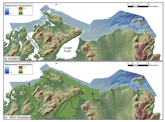
(a) Modern coastline configuration for the north coast of Ireland with bathymetric data from the JIBS survey. (b) Approximation of the lowstand configuration assuming a lowstand of -30m (Kelley et al., 2006). The areas shaded in light green show the extent of the exposed shelf. Note the narrow shelf extension in the west and the closure of the modern sea loughs to form fluvial valleys. Black dashed arrows indicate the likely paths of rivers. Given the discrepancies between different sea-level studies (e.g. compare Kelley et al. (2006) with Brooks et al. (2008), this should be regarded as the maximum extent for the submerged landscape.
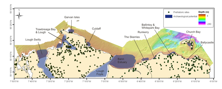
Areas identified as having archaeological potential alongside known terrestrial SMR records and overlaid onto JIBS data.
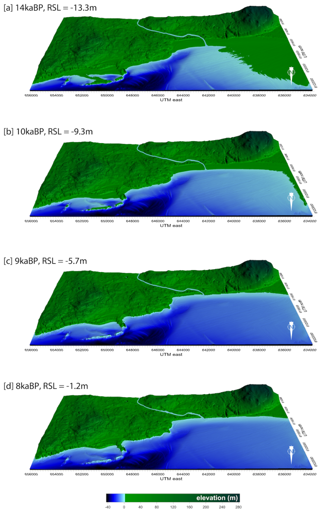
Palaeogeographic reconstruction of the Bann Estuary from 14,000 years ago (when sea level was 13.3 m lower than present) to 8,000 years ago when sea level was 1.2 m lower than present.
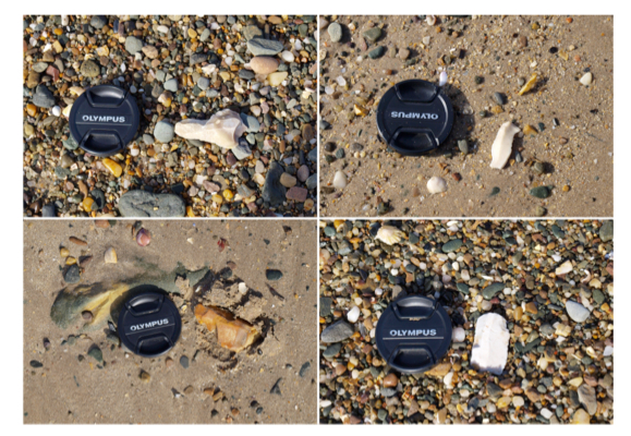
Selection of worked lithics observed on a beach at Eleven Ballyboes townland, Greencastle, Co. Donegal. This is one of the areas (Lough Swilly) identified as having high archaeological potential int he JIBS analysis. Lens cap is c. 6cm across. Finds from this beach have previously been reported in McNaught (1998) and Costa et al. (2001).
